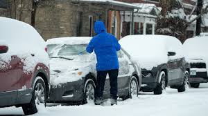
A major winter storm is expected to impact a wide swath of the United States in the coming days, prompting heightened concern among forecasters and emergency officials. The system is forecast to deliver a complex mix of snow, ice, freezing rain and bitter cold across multiple regions. Meteorologists say the storm’s size and strength could make it one of the most disruptive winter weather events of the season. Millions of Americans are being urged to prepare for rapidly changing and potentially dangerous conditions.
Weather models indicate the storm will begin organizing in the Southwest before strengthening as it moves eastward. As the system taps into moisture from the Gulf and collides with Arctic air, conditions will become increasingly volatile. This interaction is expected to fuel widespread precipitation and sharp temperature drops. The storm’s reach may extend from the southern Plains to the Northeast.
Forecasters emphasize that the sheer scale of the system sets it apart from more localized winter events. Snowfall, ice accumulation and extreme cold are all expected to occur simultaneously in different regions. This combination raises the risk of transportation disruptions, power outages and hazardous travel. Officials are closely monitoring the storm’s evolution as it advances.
Snow and Ice Threats Across Multiple Regions
In the central United States, snow is expected to fall heavily in parts of the Plains and Midwest. Some areas could receive significant accumulations over a short period, leading to snow-covered roads and limited visibility. Rural communities may face delays in road clearing, making travel particularly risky. Residents are advised to avoid unnecessary trips once conditions worsen.
Farther south, freezing rain and sleet are likely to create a separate but equally dangerous scenario. Even small amounts of ice can make roads nearly impassable and increase the likelihood of vehicle accidents. Ice buildup on trees and power lines may lead to outages that last for hours or days. Regions unaccustomed to winter weather could be especially vulnerable.
As the storm pushes east, major population centers in the Ohio Valley and Northeast are expected to see snow develop late in the weekend. Depending on the storm’s final track, some cities could experience heavy snowfall during peak commuting hours. This timing could worsen congestion and complicate emergency response. Transit agencies are already preparing for potential service disruptions.
Coastal areas may also experience strong winds alongside snow and ice. Gusty conditions can lead to blowing snow, reducing visibility and creating whiteout situations. In some locations, coastal flooding or erosion could occur if the storm coincides with high tides. These overlapping hazards increase the storm’s overall impact.
Extreme Cold and Safety Concerns
Behind the storm, an outbreak of Arctic air is forecast to plunge temperatures well below seasonal averages. In some regions, wind chill values could reach dangerously low levels. Exposure to such cold can lead to frostbite or hypothermia in a short amount of time. Health officials are urging people to limit time outdoors and dress appropriately if travel is unavoidable.
The prolonged cold could also strain heating systems and energy supplies. Increased demand for electricity and natural gas may challenge utilities, especially if ice damages infrastructure. Residents are encouraged to conserve energy where possible and report outages promptly. Backup heating plans are recommended for vulnerable households.
Emergency management agencies across several states have activated winter response plans. Crews are preparing snowplows, salt trucks and emergency shelters ahead of the storm’s arrival. Local governments are coordinating with utility providers and first responders to ensure rapid response if conditions deteriorate. Public safety messages are being widely shared through alerts and media channels.
Schools, government offices and businesses may face closures depending on how the storm unfolds. Officials stress that decisions will be made based on safety considerations and real-time conditions. Parents and workers are encouraged to stay informed through official announcements. Flexibility and preparedness will be key in the days ahead.
Long-Term Impacts and Preparedness
Beyond the immediate hazards, the storm could have lasting effects on communities hardest hit. Snow removal and ice cleanup may take several days, particularly in areas with heavy accumulation. Supply chains and deliveries could be delayed as transportation networks recover. These secondary impacts can linger even after the storm passes.
Homeowners are advised to take preventative steps before conditions worsen. Insulating exposed pipes, securing outdoor items and stocking emergency supplies can reduce damage and stress. Simple preparations may help households remain safe and comfortable during extended periods of cold or power loss. Authorities stress that preparation should be completed well before the storm arrives.
Meteorologists will continue to refine forecasts as new data becomes available. Slight changes in temperature or storm track could significantly alter local impacts. Officials recommend checking updates frequently rather than relying on a single forecast. Staying informed is one of the most effective ways to reduce risk.
Community cooperation is also being encouraged as the storm approaches. Checking on neighbors, especially older adults or those with limited mobility, can make a meaningful difference. Local shelters and warming centers may be opened where needed. Collective awareness and support can help communities weather severe conditions more safely.
While winter storms are not uncommon, the projected scope and intensity of this system have placed much of the country on alert. The combination of snow, ice and extreme cold presents challenges that extend beyond any single region. As the storm progresses, its full impact will become clearer. Until then, preparedness and caution remain the strongest defenses against the severe winter weather ahead.

